
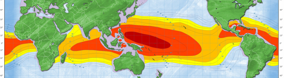
Location
A study is done to investigate the best location for thermal energy. The best potential areas are illustrated in this figure. As you can see the red color indicates the most potential thermal energy locations with an average of monthly temperature difference greater than 24˚C. This potential is decreasing toward the orange color, which has an average of monthly temperature difference between 18˚C and 20˚C.
For this case study an OTEC facility in front of the Hato Airport just north of Willemstad on Curacao. The Hato Airport is located on the north side of the island in the Caribbean Sea.
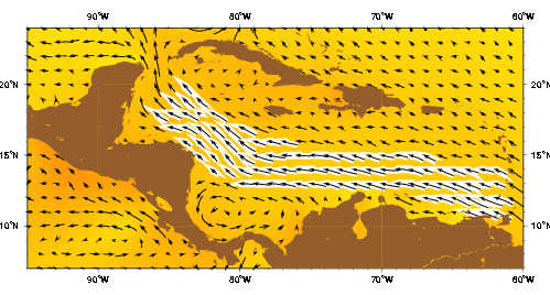
Current
The Caribbean current as represented by the Mariano Global Surface Velocity Analysis (MGSVA). The Caribbean Current transports significant amounts of water northwestward through the Caribbean Sea and into the Gulf of Mexico, via the Yucatan Current. The source water for the Caribbean Current is from the equatorial Atlantic Ocean via the North Equatorial, North Brazil, and Guiana Currents. In this area, the highest surface velocities can reach 0.70 m/s along the coasts of Venezuela and the Netherland Antilles
Click to set custom HTML
Wind & Wave Loads
The
wind and wave direction on the location of the OTEC is mainly east. There is a
moderate sea state in this area. The average wind speed is about 7 m/s and the
maximum windspeed will be estimated as 30 m/s. The
average wave height is not so large with 1 to 2 meter.

